Know Your Flood Risk
How Flooding Occurs
Flood water collects because most of Jefferson Parish lies at or below sea level with land prone to subsidence or sinking. The low, flat ground provides little gravity drainage so water that falls in the Parish must be pumped out through the integrated drainage system.
Determine your Flood Zone
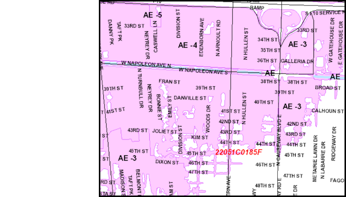
Due to the fact that much of the land in Jefferson Parish is low, your property may be in a Special Flood Hazard Area as determined by FEMA through the use of Flood Insurance Rate Maps. Maps that show flood hazard areas are on file at the Joseph S. Yenni Office Building or your local library.
Request a flood zone determination or view the flood maps by clicking on the flood map to the right or by calling Seamus Riley at (504) 736-6441.
Understand your Flood Zone
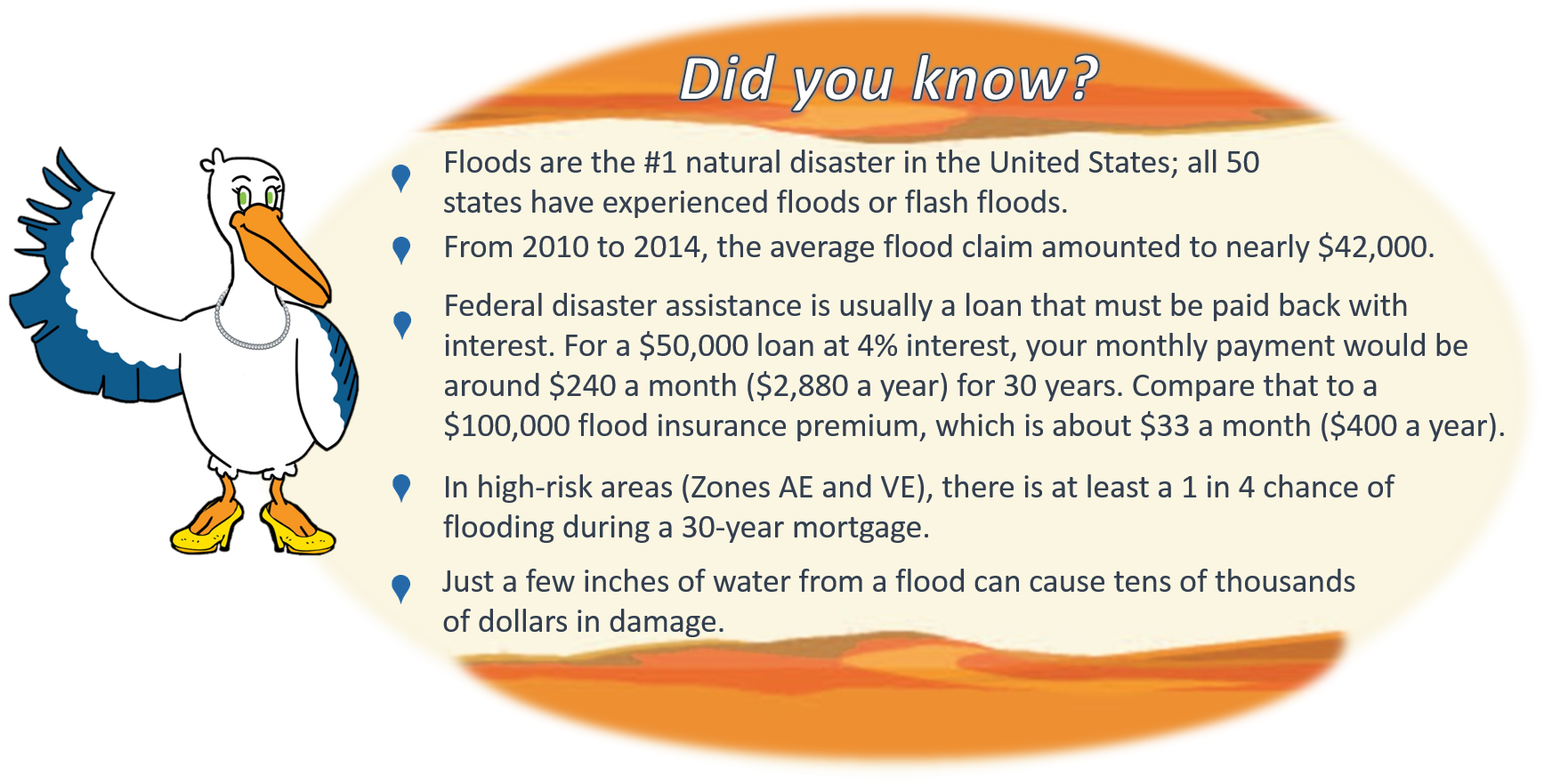
Property owner in Flood Zones AE and VE (high risk areas) are required to carry flood insurance if they have a federally backed mortgage. For properties in Flood Zones X, B and C (low to moderate risk areas), flood insurance is highly recommended as floods do not respect zone boundaries. Facts show those insured in Zones X, B and C file more than 20 percent of all flood insurance claims through the National Flood Insurance Program and receive one-third of federal disaster assistance for flooding.
Levels of Flooding
Jefferson Parish is subject to flooding from two sources. One source is storm surge from the Gulf of Mexico. The areas outside of the levee system (Crown Point, Barataria, lower Lafitte, Town of Jean Lafitte and Town of Grand Isle) are most susceptible to storm surge. The second source of flooding is flash flooding from heavy rainfall related to tropical storms, hurricanes, and unusual rain events which could affect areas inside the levee system. The inundation maps below illustrate the various levels of flooding predicted for different flooding scenarios.
Outside Levee System
Inside Levee System