Planning & Zoning Map
Joseph S. Yenni Building
1221 Elmwood Park Blvd., Suite 601
Jefferson, LA 70123
Phone Numbers:
Planning Main Line (504) 736-6320
Fax (504) 731-4560
The Jefferson Parish Planning & Zoning Map does not include information for the incorporated cities and towns of Kenner, Gretna, Harahan, Westwego, Lafitte, or Grand Isle.
View the Jefferson Parish Planning & Zoning Map
A disclaimer will open before you get to the map. Once you’ve read through the disclaimer, click Continue to Map.
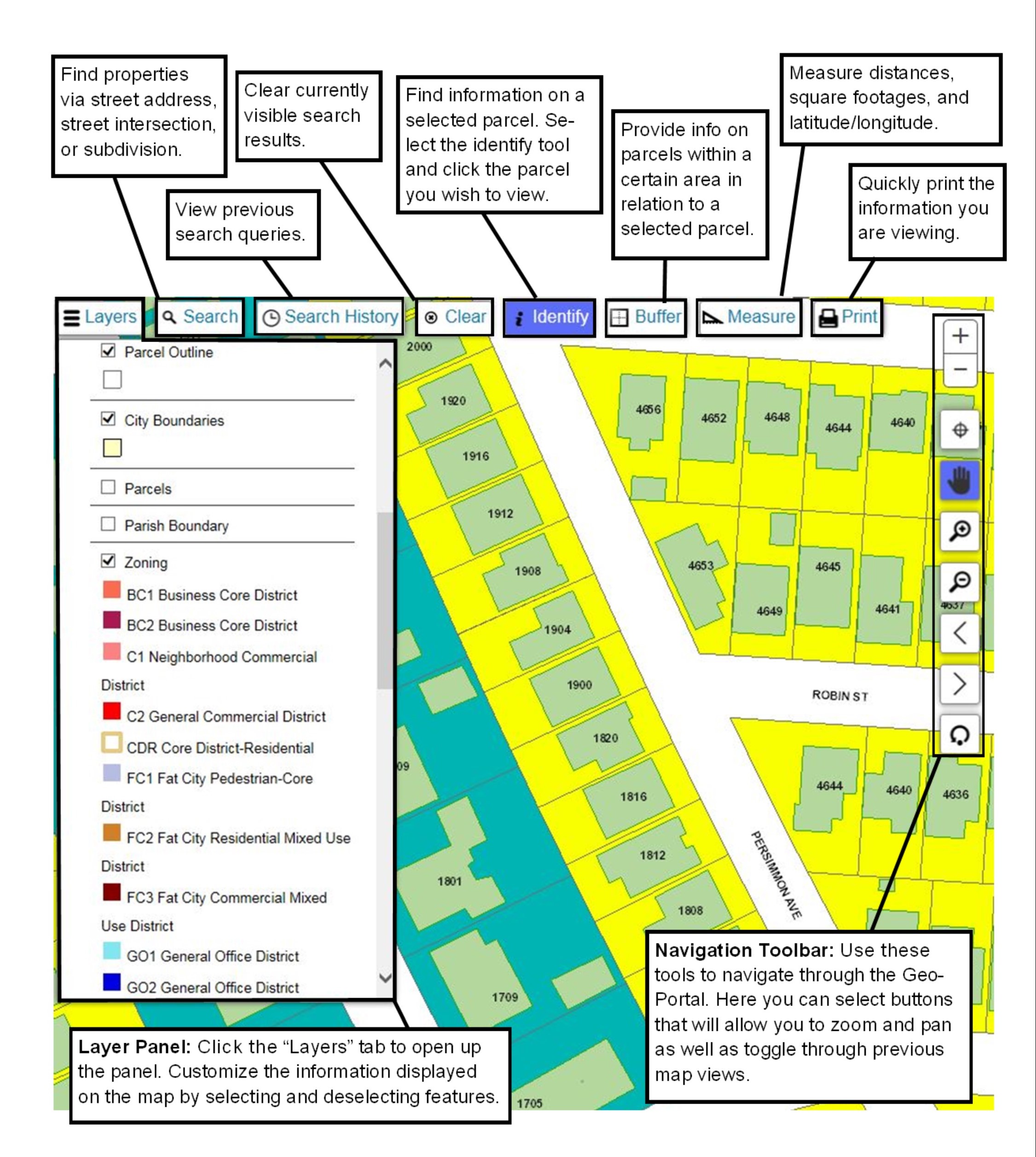
If you know the address of the property or nearest street intersection, click the Search button at the top of the screen. You may then search by address (enter street name first, then address number) or intersection. (When entering a street do not enter N., S., St., Dr., etc.)
Once you have searched for your property the map should zoom in to the site you have searched. If you have searched by intersection and are viewing a blank screen try zooming out using the tools (hover over for description) on right-side of the screen or the roller on your mouse.
If you are unsure of the address or street intersection, you may also use the tools on the right-side of the screen to zoom into areas of the parish.
Once the property is located you may view information in different ways:
- Click the Identify button at the top of the screen and then click on your property. A box should appear listing information about the property including zoning, overlays, approximate square footage, and lot, square, subdivision name.
- To check an address, click the Layers button at the top of the screen and select the box next to address number.
- To view zoning using the Layers button, select the box next to both Zoning and Zoning Overlay layers. It is suggested that you also select the box next to Parcel Outline layer to make viewing easier.
If you need an official Zoning Determination or for additional assistance, please contact the Planning Department 504-736-6320.